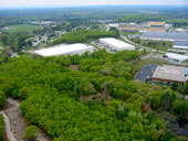
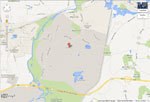
From zoning maps and street maps, to recreational trails and designated truck routes, this page contains detailed mapping information for the
Devens Regional Enterprise Zone. Don't see what you're looking for? Give us a call and we will do our best to get you the information you need.
Public office hours are generally 8:30AM–4:30PM, Monday-Friday.
- Walk Devens (walking, running and cycling routes)
- Hike Devens
- Devens Zoning Districts
- Devens Reuse Plan Map
- Devens Boundaries
- Devens Water Resource Protection Districts
- Viewshed Overlay District
- Mirror Lake Trails
- Slope Resource Areas
- Devens Historic District Map
- Guide to Devens Monuments
- Sustainability Tour of Devens
- Devens Designated Truck Route
Click here to download a map of the designated truck route for Devens. All trucks travelling to/from Devens are to utilize the highlighted routes to enter and exit Devens via Jackson Gate (Route 2). - Devens Wastewater Treatment Plant Designated/Preferred Truck Route
Click here to download the map — all septage haulers accessing the Devens Wastewater Treatment plant are required to utilize the highlighted route when going to and from the Plant.


